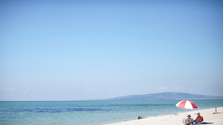
This picturesque section of the Bay Trail encompasses the Safety Beach stretch of Port Phillip Bay. Start at the Martha Cove Underpass and head south past the Safety Beach Sailing Club. Walk along the beautiful white sandy beach or on the graveled track past the instagrammable Safety Beach Jetty, a memorial to William Buckley (opposite the shops), and on towards Dromana. This section also includes some of of the Peninsula's famous colourful bathing boxes.
This walk is on a shared pathway for walkers and cyclists that is part of the picturesque 30km Mornington Peninsula Bay Trail along the Port Phillip coast from Safety Beach to Portsea.
Service Facility:
Barbecue, Boating Facilities, Carpark, Food and Refreshments, Picnic Area, Public Telephone, Public Toilet, Restaurant, Sheltered Area, Showers, One way, Walk, Grade 1, Walks
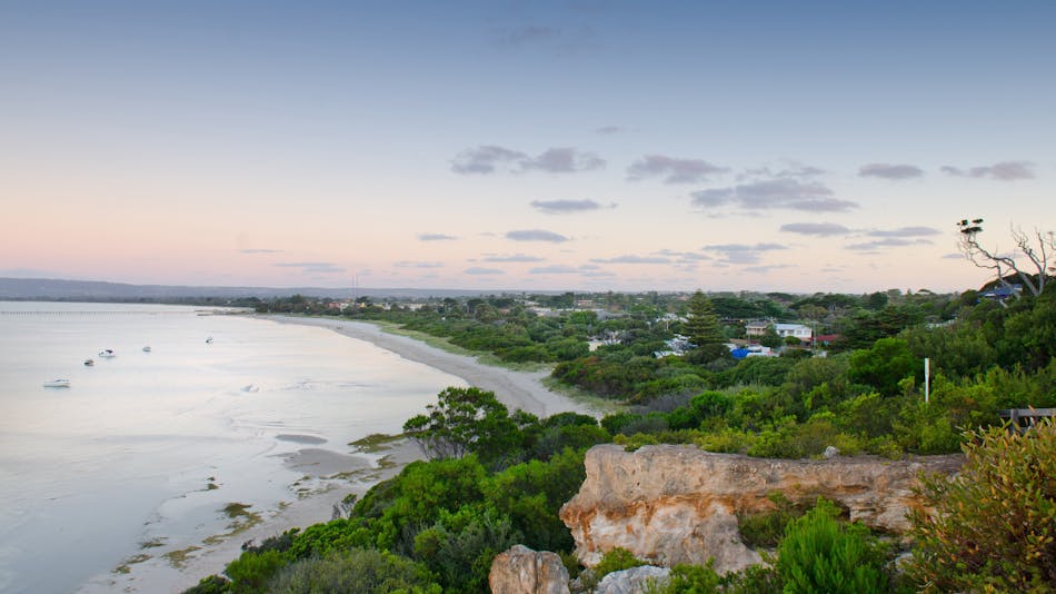
Starting at the corner of Marine Drive and Point Nepean Rd, a gravel pathway weaves in between the trees on the Dromana Foreshore and takes travelers from the Safety Beach end of Dromana, to the McCrae end at the other. The Dromana pier and the Dromana Lifesaving Club are prominent points situated about half way along this trail and the playground and reserve at the Dromana Pier offers walkers a place to relax and grab some lunch, with many shops and restaurants directly across the road. The path continues through the foreshore reserve past the Visitor Information Centre towards McCrae. This section also includes some of of the Peninsula's famous colourful bathing boxes.
This walk is on a shared pathway for walkers and cyclists that is part of the picturesque 30km Mornington Peninsula Bay Trail along the Port Phillip coast from Safety Beach to Portsea.
Service Facility:
Bar, Barbecue, Boating Facilities, Cafe, Caravan / Camper Trailer / Campervan Sites, Carpark, Coach Parking, Food and Refreshments, Lookouts, Park Info Centre, Picnic Area, Public Telephone, Public Toilet, Restaurant, Shaded Area, Sheltered Area, Shop / Gift Shop, Showers, One way, Walk, Grade 1, Walks
This walk starts near the intersection of Point Nepean Road and La Trobe Parade, on the southern end of the Dromana foreshore. At the end of the camping area, the path goes though the boat ramp parking, and around the 'Anthony's Nose' headland which is a popular fishing location. The path winds through the camping sites of the foreshore before heading past the village of McCrae with its lighthouse and the McCrae Yacht Squadron.
Through more campsites under the mature Coastal Banksia trees and along onto the gravelled paths of the foreshore camping areas of Rosebud. Past the Rosebud Pier wiht its wonderful kids playground opposite Jetty Road and passing through the sheltered Rosebud Foreshore with beautiful shell-covered stretches of beach. Opposite are many shops and cafes of Rosebud. This section finishes at Chinamans Creek, Capel Sound.
This walk is on a shared pathway for walkers and cyclists that is part of the picturesque 30km Mornington Peninsula Bay Trail along the Port Phillip coast from Safety Beach to Portsea.
Service Facility:
Bar, Barbecue, Boating Facilities, Cafe, Campsites, Caravan / Camper Trailer / Campervan Sites, Carpark, Picnic Area, Public Telephone, Public Toilet, Shaded Area, Sheltered Area, Shop / Gift Shop, Showers, One way, Walk, Grade 1, Walks
Capel Sound Foreshore Reserve is located along a 3.75km stretch of foreshore at Capel Sound (formerly Rosebud West). Generally the path surface is 2m wide and made of asphalt. This section of the Bay Trail takes travellers from Chinamans Creek through the Capel Sound camping grounds to the Rye foreshore opposite Marshall Street. You can stop at a cafe or do a spot of shopping at the village shopping strip close to Chinamans Creek, or at Rye. This section also includes some of of the Peninsula's famous colourful bathing boxes.
This walk is on a shared pathway for walkers and cyclists that is part of the picturesque 30km Mornington Peninsula Bay Trail along the Port Phillip coast from Safety Beach to Portsea.
Service Facility:
Barbecue, Boating Facilities, Cafe, Campsites, Caravan / Camper Trailer / Campervan Sites, Carpark, Food and Refreshments, Picnic Area, Public Toilet, Restaurant, Shaded Area, Sheltered Area, Shop / Gift Shop, One way, Walk, Grade 1, Walks
Starting at the beginning of the Rye foreshore camping area opposite Marshall Street, passing through the camping grounds alongside bathing boxes dotted along the track, and finishing at the Rye Pier. The route passes the Rye shopping precinct with great cafes and the Rye Hotel - perfect for a spot of lunch.
This walk is on a shared pathway for walkers and cyclists that is part of the picturesque 30km Mornington Peninsula Bay Trail along the Port Phillip coast from Safety Beach to Portsea.
Service Facility:
Bar, Barbecue, Boating Facilities, Campsites, Carpark, Coach Parking, Food and Refreshments, Picnic Area, Public Telephone, Public Toilet, Restaurant, Shaded Area, Sheltered Area, Shop / Gift Shop, Showers, One way, Walk, Grade 1, Walks
An easy walk along the foreshore from Rye Pier to Canterbury Jetty Road. About a kilometre to the west of Rye Pier is White Cliffs - a rocky cliff outcrop on a small hill. At the base of the outcrop is a reconstructed Lime Burners Kiln that was built as a tribute to one of the major industries for the early settlers in the Rye area. During the mid 1800's, natural limestone was mined in the Rye area. It was then burnt in kilns such as this, to turn it into lime which was then shipped to Melbourne for use in the building industry. The last commercial burning of lime on the Peninsula was carried out in the Rye area.
From the reconstructed Limeburners kiln there are steps leading to a lookout area at the top of the cliff, and while it is probably less than one hundred feet high, the views both to the East towards Arthur's Seat and West towards Blairgowrie are quite stunning on a sunny day.
To continue towards Blairgowrie you will need to retrace your steps to cross Point Nepean Rd opposite Minnimurra Rd to a shared pathway. The walk then heads towards Blairgowrie.
This walk is on a shared pathway for walkers and cyclists that is part of the picturesque 30km Mornington Peninsula Bay Trail along the Port Phillip coast from Safety Beach to Portsea.
Service Facility:
Barbecue, Boating Facilities, Cafe, Campsites, Carpark, Lookouts, Public Toilet, Sheltered Area, Shop / Gift Shop, One way, Walk, Grade 1, Walks
Follow the Bay Trail from opposite Canterbury Jetty Road to the Blairgowrie Shops just past St Johns Wood Road where you can have some refreshments. The path winds through impressive stands of Moonah trees bordering the beach. This short section also includes some of of the Peninsula's famous colourful bathing boxes, and the impressive yachts of the Blairgowrie Yacht Squadron.
This walk is on a shared pathway for walkers and cyclists that is part of the picturesque 30km Mornington Peninsula Bay Trail along the Port Phillip coast from Safety Beach to Portsea.
Service Facility:
Bar, Boating Facilities, Cafe, Carpark, Coach Parking, Picnic Area, Public Telephone, Public Toilet, Restaurant, Sheltered Area, Shop / Gift Shop, One way, Walk, Grade 1, Walks
This short section of the Bay Trail takes travellers through Blairgowrie shops from opposite St Johns Wood Road to Camerons Bight. Setting off from the Blairgowrie Marina where a $25 million marina expansion and clubhouse redevelopment was recently completed. Blairgowrie Yacht Squadron offers world class facilities in a relaxed and casual setting. Just past there as the beach merges into Camerons Bight there is a picturesque small jetty almost opposite the end of Hughes Rd that is worth a photograph.
This walk is on a shared pathway for walkers and cyclists that is part of the picturesque 30km Mornington Peninsula Bay Trail along the Port Phillip coast from Safety Beach to Portsea.
Service Facility:
Boating Facilities, Carpark, One way, Walk, Grade 1, Walks
Eastern Sister Headland connects Camerons Bight to Sullivan Bay at Sorrento provides easy access around the historic Eastern Sister Headland situated at the northern end of Camerons Bight and the southern end of Sullivan Bay.
The 270-metre-long rock revetment is topped with a two-metre-wide crushed rock pathway. The pathway, allows pedestrians better access the historically significant Collins Settlement Historic site - the first European settlement in Victoria dating back to 1803 and includes graves, monuments and lookout structures.
This walk is on a shared pathway for walkers and cyclists that is part of the picturesque 30km Mornington Peninsula Bay Trail along the Port Phillip coast from Safety Beach to Portsea.
Service Facility:
Carpark, Lookouts, One way, Walk, Grade 1, Walks
Travel from Sullivans Bay to Sorrento Pier through the camping grounds with the beautiful calm sandy bay beaches of Sorrento. The path winds past a small pier and alongside statuesque Norfolk Island Pines to the pier where the Sorrento -Queenscliff ferry berths.
This walk is on a shared pathway for walkers and cyclists that is part of the picturesque 30km Mornington Peninsula Bay Trail along the Port Phillip coast from Safety Beach to Portsea.
Service Facility:
Cafe, Picnic Area, Public Toilet, One way, Walk, Grade 1, Walks
This section of the Bay Trail travels from the Sorrento Pier, through the large and scenic Sorrento Park with its adventurous playground, and inland past the majestic properties of Portsea. It finishes by going through the village of Portsea and ends at the entrance of the Point Nepean National Park.
A short diversion can include the stretch known as Millionaire's Walk between Point King Road and Lentell Avenue.
This walk is on a shared pathway for walkers and cyclists that is part of the picturesque 30km Mornington Peninsula Bay Trail along the Port Phillip coast from Safety Beach to Portsea. You can extend this walk further by continuing into the Point Nepean National Park.
Service Facility:
Bar, Carpark, Coach Parking, Lookouts, Picnic Area, Public Telephone, Public Toilet, Restaurant, Shaded Area, One way, Walk, Grade 1, Walks